A 1962 Pathe news story on the restoration of the Stratford-upon-Avon Canal. The restoration of this canal in the 1960s was just the start of the regeneration of the inland waterway network we have today.

Thursday 29 March 2018
Sunday 25 March 2018
Scarfields Dingle Aqueduct
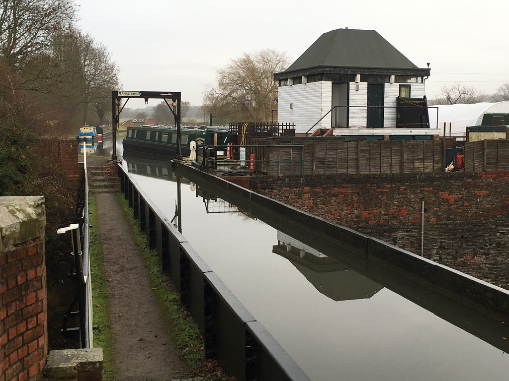
Aqueducts come in a variety of sizes, for example the M5 Aqueduct that takes the Tame Valley Canal over the M5 Motorway or the 145m long Edstone aqueduct that takes the Stratford Canal over railway lines. A rather more modest aqueduct is the Scarfields Dingle Aqueduct near Alvechurch. The aqueduct has no apparent road or stream it allows under the canal, there is a rather low walkway and that is it.
In fact the aqueduct was built for a once well-used track between Alvechurch and Droitwich. The track was built for the salt trade and existed from before the Domesday Book, which lists Alvechurch having a number of salt houses supplied by salt from the saline springs at Droitwich. The track was known as Cobley Lane (the aqueduct is sometimes known as Cobley Lane Aqueduct). More about Cobley Lane can be seen here.


In fact the aqueduct was built for a once well-used track between Alvechurch and Droitwich. The track was built for the salt trade and existed from before the Domesday Book, which lists Alvechurch having a number of salt houses supplied by salt from the saline springs at Droitwich. The track was known as Cobley Lane (the aqueduct is sometimes known as Cobley Lane Aqueduct). More about Cobley Lane can be seen here.


Wednesday 21 March 2018
Macclesfield Bridge
There are hundreds of bridges that cross Britain's canals and rivers, the names of which are sometimes quite straightforward to understand though others are rather more mysterious. Take Macclesfield Bridge that crosses the Regent's Canal near Regent's Park for example, how did it get this name?
The bridge, which was designed by James Elms in 1829, was in fact named after the Earl of Macclesfield who was the chairman of the Regent's Canal Company at the time. It gained a new name in 1874 when a barge carrying gunpowder exploded under the bridge destroying it. After the bridge was rebuilt bargemen often referred to it as "Blow Up Bridge"! [1]

[1] Michael Essex-Lopresti, Exploring the Regent's Canal (Brewin Books, 2008) p. 51
Sunday 18 March 2018
River Tame
The River Tame is the main river in the West Midlands, though is a tributary of the mighty Trent. The river's sources are in Oldbury and Willenhall which link up at Bescot and the river then flows East through the North of Birmingham before heading up to Tamworth (which gained its name from the river) and finally joins the Trent at Alrewas and then you eventually reach the North Sea via the Ouse.
The Tame basin is the most urbanised in Britain with 42% of it in built-up areas. This has had a dramatic effect on the river with it becoming notoriously polluted during the Industrial Revolution and was once regarded as one of Britain's dirtiest rivers. Although the river has never been made navigable (although there were proposals in the 19th century to use it and the Trent to link Birmingham to the Humber) it was heavily used for industrial and agricultural processes from as early as the 12th century.
However the nature of the river meant that this was later than in some other areas. A number of water mills were sited along the river in places such as Sandwell, Bromford and Minworth to grind wheat. Later on the power of water was used to drive bellows and hammers. Such was the demand of industry on the river and its feeding streams that there were often disputes between millers over water supply. Some furnaces in places like Hamstead had to be closed down due to insufficient water supply however by the 19th century steam was replacing water wheels as the primary source of power.
Much of the river's early course, especially in its Willenhall and Oldbury Arms have been modified by man. The construction of the motorways also meant that the course of the river had to be changed especially near the Gravelly Hill Interchange (Spaghetti Junction) in Northern Birmingham and near the M5 in Bescot.
More recent remodeling from the 1980s onwards has tried to prevent flooding and also improve the habitat for wildlife. Now much of the river is a haven for wildlife including geese and swans but flows quietly away from much attention as is winds its way through the big city and beyond.
References:
W.B. Stephens (Editor). "Economic and Social History: Mills." A History of the County of Warwick: Volume 7: The City of Birmingham (1964): 253-269. British History Online. Web. 19 April 2012. <http://www.british-history.ac.uk/report.aspx?compid=22970>
Post Office Directory of Birmingham, 1867 p 359
History, Gazetteer & Directory of Warwickshire, 1850 p 84
Charles Anthony Vince, History of the Corporation of Birmingham Vol 3 1885-1899 (Birmingham: Cornish Brothers 1902), p 366
The Tame basin is the most urbanised in Britain with 42% of it in built-up areas. This has had a dramatic effect on the river with it becoming notoriously polluted during the Industrial Revolution and was once regarded as one of Britain's dirtiest rivers. Although the river has never been made navigable (although there were proposals in the 19th century to use it and the Trent to link Birmingham to the Humber) it was heavily used for industrial and agricultural processes from as early as the 12th century.
However the nature of the river meant that this was later than in some other areas. A number of water mills were sited along the river in places such as Sandwell, Bromford and Minworth to grind wheat. Later on the power of water was used to drive bellows and hammers. Such was the demand of industry on the river and its feeding streams that there were often disputes between millers over water supply. Some furnaces in places like Hamstead had to be closed down due to insufficient water supply however by the 19th century steam was replacing water wheels as the primary source of power.
Much of the river's early course, especially in its Willenhall and Oldbury Arms have been modified by man. The construction of the motorways also meant that the course of the river had to be changed especially near the Gravelly Hill Interchange (Spaghetti Junction) in Northern Birmingham and near the M5 in Bescot.
More recent remodeling from the 1980s onwards has tried to prevent flooding and also improve the habitat for wildlife. Now much of the river is a haven for wildlife including geese and swans but flows quietly away from much attention as is winds its way through the big city and beyond.
 |
| Alongside the Aston Expressway near Spaghetti Junction |
 |
| At Holford |
 |
| At Tamworth |
References:
W.B. Stephens (Editor). "Economic and Social History: Mills." A History of the County of Warwick: Volume 7: The City of Birmingham (1964): 253-269. British History Online. Web. 19 April 2012. <http://www.british-history.ac.uk/report.aspx?compid=22970>
Post Office Directory of Birmingham, 1867 p 359
History, Gazetteer & Directory of Warwickshire, 1850 p 84
Charles Anthony Vince, History of the Corporation of Birmingham Vol 3 1885-1899 (Birmingham: Cornish Brothers 1902), p 366
Friday 16 March 2018
Typhoo Basin
Typhoo Basin is a short arm of the Digbeth Branch Canal in Birmingham which takes it's name from the 1930s built Typhoo Tea factory which used to operate here on Bordesley Street. The basin is not the most welcoming for boaters (and often locked up out of use). However the site may become a high-tech centre for innovation in a £200 million project called STEAMhouse which will be located in the factory. The wharf as well would spruced up and made a lot more welcoming and visitor friendly.


Tuesday 13 March 2018
LV14 Lightship Sula
Lightships are basically mobile lighthouses. They are used in waters where it is impractical/impossible to build a permanent lighthouse. Lightships have been in use around British waters since 1734 and a number are still in use around the coast. These days lightships tend to be unmanned.
A number of older lightships still survive as preserved boats. One of them is Lightship Sula which once served at Spurn Head off the Humber estuary. Sula was decommissioned in 1985 and has had a varied life since in retirement including being the headquarters of a yacht club and an alternative therapies centre. Now it is moored at Gloucester Docks.


A number of older lightships still survive as preserved boats. One of them is Lightship Sula which once served at Spurn Head off the Humber estuary. Sula was decommissioned in 1985 and has had a varied life since in retirement including being the headquarters of a yacht club and an alternative therapies centre. Now it is moored at Gloucester Docks.


Sunday 11 March 2018
Wednesbury Old Canal
The Wednesbury Old Canal is part of the Birmingham Canal Navigations and links the Walsall and Birmingham Main Line Canals. The canal was opened as part of the original Birmingham Canal in 1769. Later canal building replaced part of its stretch especially where it met the later Birmingham New Main Line.
Like most canals the Wednesbury Old Canal went into decline in the 20th century and was considered abandoned in the 1950s. However parts of it are still available for navigation.
The Ridgacre Branch and the canal from Swan Bridge Junction to the original termination point at Balls Hill Basin are no longer accessible to boats have due to a new road bridge which left insufficient headroom for boats.

The canal is still navigable for over a mile between Pudding Green and Ryder's Green Junctions (and a little beyond the latter).


| Information | |
|---|---|
| Opened: | 1769 |
| Route: | West Midlands |
| Distance: | 7.1km |
| Status: | Partially open, some canal bed lost |
The Ridgacre Branch and the canal from Swan Bridge Junction to the original termination point at Balls Hill Basin are no longer accessible to boats have due to a new road bridge which left insufficient headroom for boats.
The canal is still navigable for over a mile between Pudding Green and Ryder's Green Junctions (and a little beyond the latter).


Tuesday 6 March 2018
Wootton Wawen Aqueduct
Wootton Wawen aqueduct, in the Warwickshire village of Wootton Wawen, is one of three aqueducts on the Southern section of the Stratford-upon-Avon Canal. Like the other two (Yarningale and Edstone) the Wootton Wawen aqueduct is unusual in having the towpath on the same level as the canal bottom.
The aqueduct was erected in 1813 by the Stratford Canal Company and is a cast iron trough with integrated towpath.


The aqueduct was erected in 1813 by the Stratford Canal Company and is a cast iron trough with integrated towpath.

Subscribe to:
Posts (Atom)